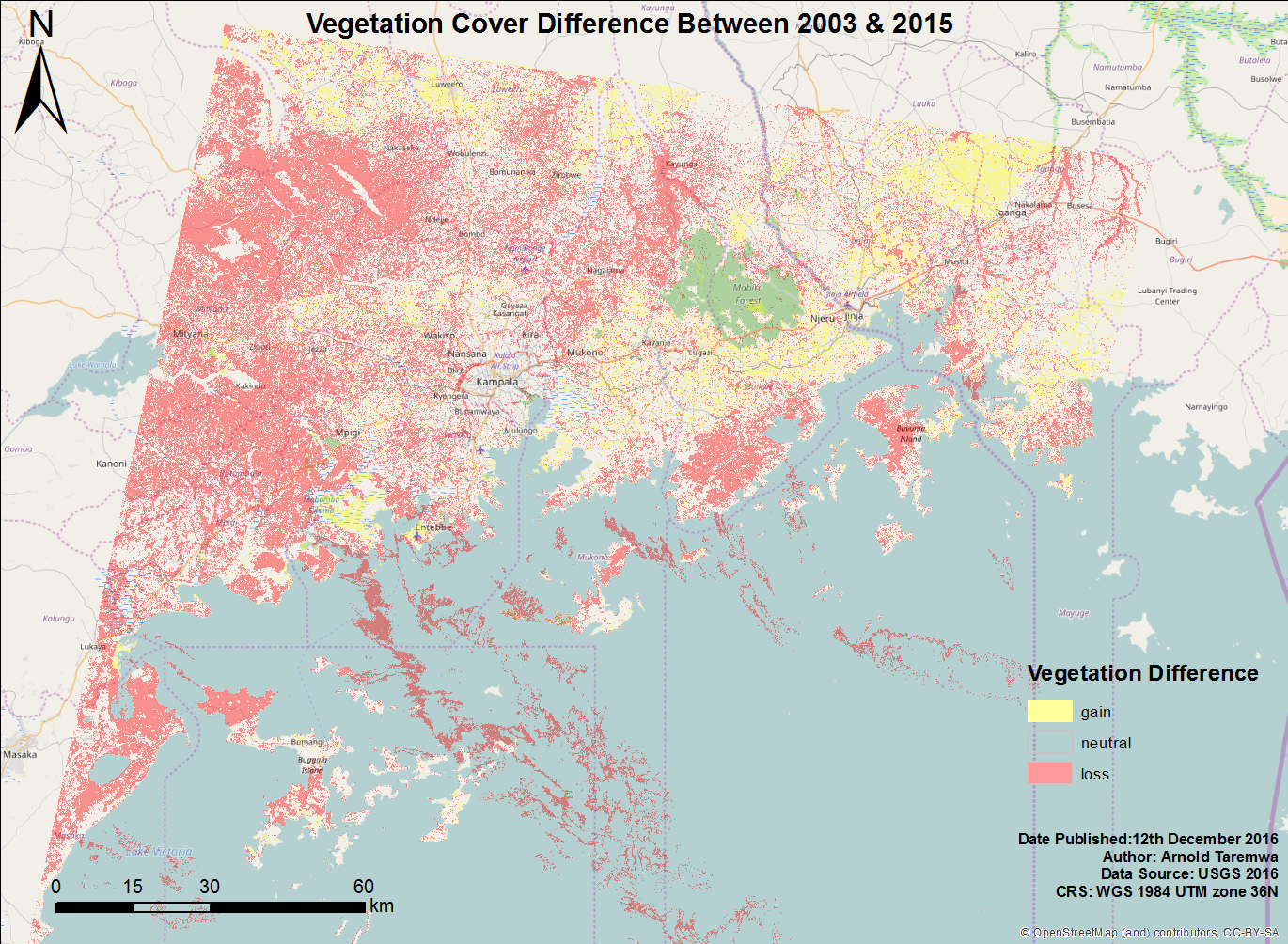
Vegetation cover all over the world has been on the decline for many years now. We all know this. The UN points out forest area loss from 31.7 % of the world's total land mass to 30.7 % between 1990 and 2015 (Sustainable Development Goal 15). But when its a gradual process, it can be hard to notice within your neighbourhood.
The reclamation of a wetland along my way to Kampala city, one that I found serene for the longest time, pushed me to see how much the growing population was affecting vegetation in the area.
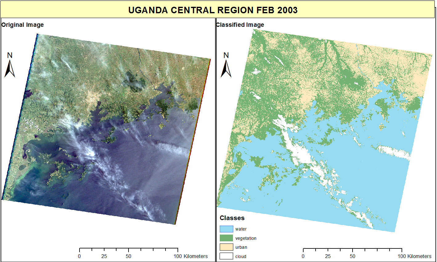
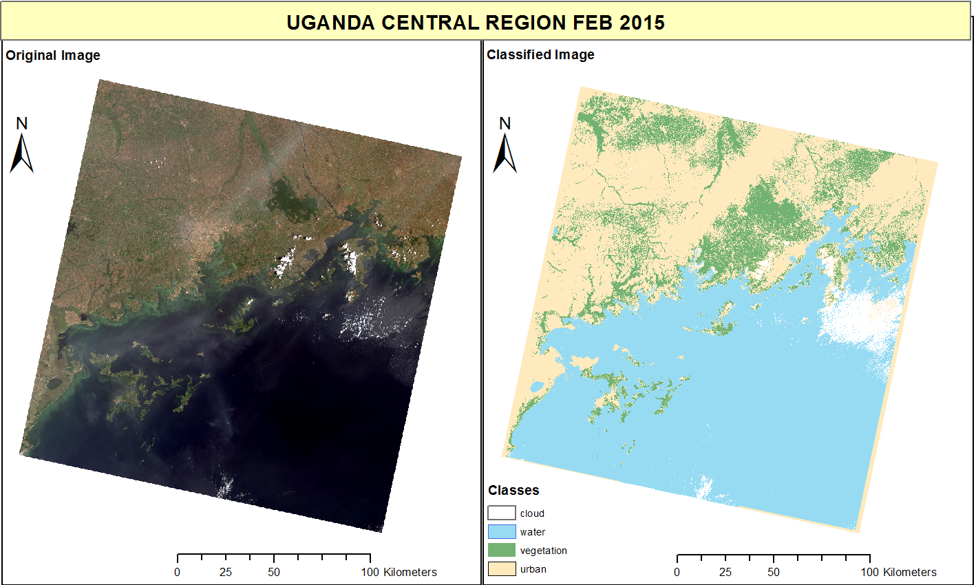
I did some image classification of Landsat images from 2003 and 2015 of Central Uganda to map areas of green cover(this included anything with the colour green; trees, shrubs, wetlands, gardens etc) in the area. This was a simple project, but I found the resulting difference in green cover to be significant enough.
Comments
comments powered by Disqus